- Shortcut Menu
- Body Shortcut
- Main Menu Shortcut
- 1) Development Status of Earth Observation Satellite in Korea
- 2) Ministry of Science and ICT
- 3) Spatial information system by Theme
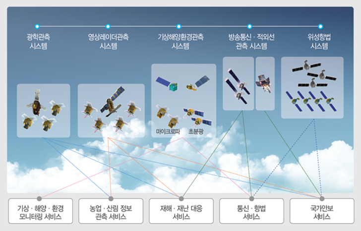
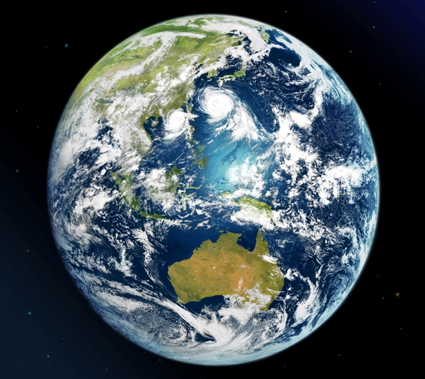
Development Status of Earth Observation
Satellite in Korea
National Earth Observation Satellite
Information Service Status
Development Status of Earth Observation Satellite in Korea
TOPSatellite Development and Application Strategies in the Mid and Long Term Plan of National Space Development
TOPAccording to the mid and long term plan of space development established in 2013, Korea is aiming to enhance its national status and contribute to national economic development by strengthening its independent space development capability. One of the six major tasks includes "satellite information application system for the improvement of the quality of life of the people'. Moving away from supply focused policy and providing customized satellite information focusing on demanders such as weather, ocean, environment, agriculture and forest, disasters, communication navigation, and land management, the purpose of this project is to expand satellite application service by constructing a satellite information application support system at government level.
Korea Multi-Purpose Satellite (KOMPSAT. Arirang)
TOPThe history of Korea's satellites started with the launch of 'KITSAT No. 1' on August 11, 1992 at the French Guiana Kourou Space Center in South America. The KAIST Satellite Research Center was built by the Surrey University in the UK and after such success, Korea too became a satellite power. In September 1993, 'KITSAT No. 2', developed by Korea's own technology, was launched.
Subsequently, in 1996, the mid and long term basic plan for space development was established as a national plan the development of a practical satellite was promoted based on this.
The multi-purpose satellite (Arirang Satellite) No. 1 was developed for three purposes: mapping of the Korean peninsula, ocean observation and scientific experiment. For this, a high resolution panchromatic electro-optical camera with a spatial resolution of 6.6m, a multi-spectral ocean observation camera with a spatial resolution of 1km, a high energy particle detector (HEPD) and an ionospheric measurement sensor (IMS) was equipped to successful launch it on December 1992.
After four more years of activity than planned, it finished its mission on February 2008.
The Earth observation satellite developed by Korea is the multi-purpose practical satellite No.2. It was successfully launched in July 2006 as a multi-spectral optical satellite with a spatial resolution of 1m, designed for the purpose of monitoring and coping with large-scale disasters, domestic and overseas precision digital map, monitoring of ocean pollution and red tide, monitoring of agricultural disasters and exploration of natural resources. Until now, it is conducting missions to observe the Earth years after its life expectancy.
The multi-purpose satellite No.3 launched in May 2012 is an ultra-high resolution Earth observation satellite equipped with an electro-optical camera with a spatial resolution of 0.7m. It is used to observe the Earth by circulating 15 times a day at an altitude of 685 km. It has significance as the first sub-meter class optical satellite in Korea. The high resolution electronic optical camera of multi-purpose satellite No. 3, AAEISS-A (Advanced Earth Imaging Sensor System-A), which was developed based on the design of multi-purpose satellite No. 3 and launched in March 2015, enables the optical imaging of 0.5m class which is the highest resolution among domestic satellites and thus after the US, provides video of 50cm or less. Furthermore, it is significant in that it is the world's first satellite to be equipped with a mid-infrared sensor, and it can detect the heat of the ground regardless of the nighttime or weather conditions, observing fire, volcanic activity, urban heat island phenomenon. It is operated at an altitude of 528km in the sun's synchronous orbit, passing Korean airspace two times (day and night) everyday to shoot the Korean peninsula for a maximum of 50 minutes.

The multi-purpose satellite NO. 5, equipped with Korea's first all-weather SAR (Synthetic Aperture Radar), was launched on August 2013 before No. 3A was launched. The image radar mounted on multi-purpose satellite No. 5 has an advantage that it can radiograph the microwave to the ground target and synthesize the reflected signal to make the image to allow Earth observation during day and night as well as during bad weather. It can supplement the disadvantage of optical satellites and thus can be mutually supplementary with the high resolution optical image of multi-purpose satellite No. 3 and No. 3A. The multi-purpose satellite No.5 can observe the Korean peninsula four times a day, and the transmitted image information is being used for public safety, disaster prediction, land and resource management and environmental monitoring.
As such, the multi-purpose satellite is operated in mutually supplementary manner as a low orbit Earth observation satellite series with optical and imaging radar satellites and infrared observing capability, thereby satisfying the demand of the application of the national satellite information. The multi-purpose practical satellite No. 6 that improves the current image radar performance and the multi-purpose practical satellite No.7 equipped with high precision optical and infrared sensors are being developed.
Communication, Ocean and Meteorological Satellite (COMS, Chollian)
TOPGeostationary satellites, which are designed to turn the Earth at a speed of 11,000km/h, which is equivalent to the Earth's rotation speed at an altitude of about 36,000km above the equator, can be mainly used for meteorological observations and telecom relaying because they can observe widely at one direction of the Earth. The first geostationary satellite launched on June 2010, Chollian No. 1, is a composite satellite equipped with three functions of communication, ocean, and weather. Satellite communication service and observation of weather around the Korean peninsula are conducted for 24 hours a day.
With the successful launch and operation of the Chollian No. 1, Korea became the seventh largest meteorological satellite nation in the world, following the US, Europe, Japan, China, India and Russia. Consequently, it has become possible to provide high precision weather service by self-reliance, moving away from foreign dependence of weather information. It is meaningful that while initially weather information was provided from Japan, Chollian No. 1 receives and provides weather information to other countries to increase the status of the country to a provider of weather information from receiver.
The ocean payload mounted on Chollian No.1 is the first ocean observation camera in the world. As the first ocean observation geostationary satellite, it observes the sea around the Korean Peninsula eight times a day to provide information on the ocean environment and fisheries resources and monitor them real time. Moreover, the 10th communication satellite in the world was self-developed and laid the basis for next generation satellite information communication system such as satellite communication, broadcasting, geographical information, and traffic information.
The Chollian No. 2 is a successive satellite to succeed the mission of Chollian No. 1 and to enhance the environmental monitoring ability around the Korean Peninsula; it is divided into the meteorological and space weather observation satellite (No. 2A) and the ocean and environmental observation satellite (No. 2B). Chollian No. 2A was successfully launched on December 5, 2018 and is currently in initial operation stage. Compared to the Chollian Satellite, the resolution of Chollian No. 2A is 4 times higher, the observation cycle is more than 3 times higher and the observation channel is more than 3 times. It is expected that the accuracy of precision weather observation and weather forecast will be improved and the ability to monitor and forecast abnormal weather on the Korean Peninsula and Asia will be further improved.
The resolution of the ocean payload of Chollian No. 2B, an environmental and ocean observation satellite that is expected to be launched in 2019, is expected to be more than four times higher than that of Chollian Satellite No. 1. The environmental payload is 7km in resolution and 8 times a day, the movement of air pollutants across the border such as yellow sand and minute particulate matters surrounding the Koran peninsula will be monitored. The satellite observation satellite (No. 2A) of Chollian No. 2 is expected to be launched in 2018, and the Ocean and Environmental Observation Satellite (No. 2B) is expected to be launched in 2019.
Ministry of Science and ICT
TOPThe images collected from Earth observation satellites are creating immense added value by being applied in various fields such as land management, disaster monitoring, ocean and water resource management, application in agriculture and forestry industry, environmental monitoring, and national security. The global satellite imaging market was estimated to be about $1.7 billion in 2015 and will grow steadily every year and to reach a figure of approximately $ 3 billion by 2025. Korea has secured about 100,000 satellite images annually through the multi-purpose satellite service series, which is a low-orbit Earth observation satellite, and distributes about 6,000 high-resolution images annually to government departments, its affiliates as well as private sectors.
Distribution and application of multi-purpose practical satellite image materials
TOPThe mompsat image data is provided for users in both public and commercial sectors into the distribution of a consultative body, public distribution and commercial distribution in accordance with the "Regulation regarding Provision and Application of Satellite Information" of the Ministry of Science, ICT and Future Planning. The related work is managed by the National Satellite Information Application Support Center at the Korea Aerospace Research Institute (hereinafter KARI). The application of satellite information for the purpose of national demand is supported free of charge centering on the 'Satellite Information Application Consultative Body' and an exclusive distribution system for this has constructed and being operated. The public distribution of satellite images for nonprofit public projects and support of scholarly research is managed by KARI and can be distributed through a certain procedure after registering as a user group. Other satellite information for domestic and overseas commercial use is sold through private sales agencies and one must obey the National Spatial Information Security Management Guidelines.
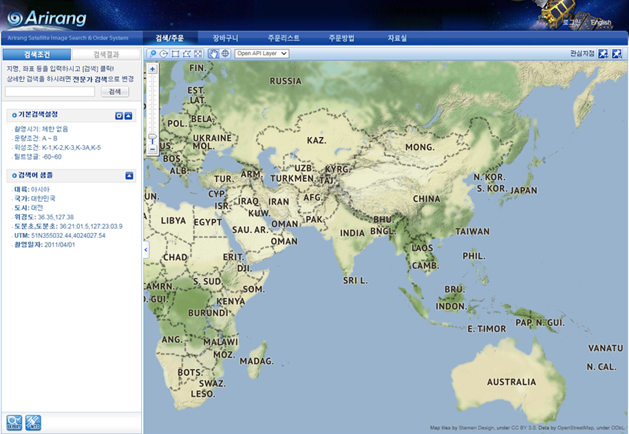
The 'Arirang Satellite Search/Order System' is being operated for the distribution of the multi-purpose practical satellites.
Distribution and application of the Chollian weather satellite image
TOPThe principal purpose of the weather satellites is to the application of weather forecasts. For this, the Korea Meteorological Administration is operating a weather satellite receiver and receives, processes and analyzes signals from weather satellites to produce diverse weather satellite analytical data, which are used for daily weather forecasts and forecasts of weather events such as yellow dust, heavy rain, and typhoon . The Korea Meteorological Agency has a system that can easily and quickly retrieve satellite images and analysis data from the meteorological offices across the country through the intranet. It provides weather forecasters with diverse satellite analysis data and detailed weather information for safe operation of airplanes and ships. The primary goal is to generate input data for numerical forecasts using supercomputers and to support local forecasting services.
Some data such as satellite images and sea surface temperature analysis data, are also provided to private forecasting operators and institutions. The data is transmitted through a private forecasting service provider support server operated by the Korea Meteorological Administration and the he private forecasting service providers use the weather data including satellite data to develop and sell specialized weather service products.
The satellite data possessed by the Korea Meteorological Administration can be said to be highly useful as research data for weather research institutes and universities. To support the application of academic and research purposes, a weather satellite data providing system (ftp site) is constructed to manage user accounts and passwords so that users outside the Korea Meteorological Administration can easily access them. The data contained in the weather satellite data providing system are open only to national and municipal agencies that conduct joint research projects with the Korea Meteorological Administration. The other weather information service for general users is to provide the data at a certain fee through the petition application procedure according to the petition management regulation. It provides weather satellite images and analysis data available from the Korea Meteorological Agency and the National Weather Satellite Center homepage. The satellite data being serviced are as follows.
| Service Data | Geostationary satellite |
Chollian, MTSAT, FY-2D |
| Polar orbiting satellite | NOAA(15,18,19), ASCAT, AQUA/TERRA, WINDSAT, SSMIS |
|
| Service Area | 전구, whole Earth, East Asia, Korean Peninsula, Korean Peninsula Region, Northern Hemisphere, West Asia, Iraq, 합성 |
|
| Data Type | Binary data (h5, he5, bin, asc), Image data (jpeg,png,gif) | |
| Image Data | Basic Image |
Infrared image, steam image, visible image, short wave infrared image, synthesized image , weighted image |
| Analysis Image | Cloud detection, Earth surface temperature, surface arrival solar radiation quantity, upper steam quantity, perceptible water quantity, cloud analysis, fog, rainfall strength, aerosol, atmospheric movement vector, sea surface temperature, ice melting snow tracing, Earth emission radiant quantity |
Contents of Weather Satellite Data Service (Source: Weather Satellite Center)
Distribution and application of Chollian ocean satellite images
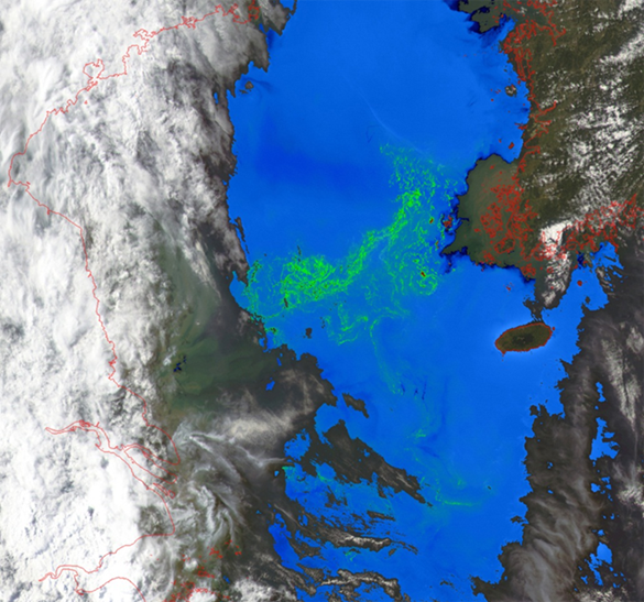
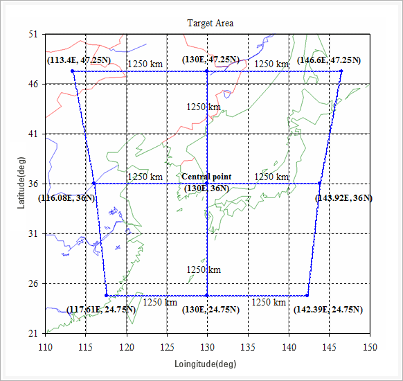
TOPThe ocean observation conducts main missions of quasi-real-time monitoring of ocean ecosystem surrounding the Korean Peninsula, long and short term ocean environment and climate change monitoring, coastal and ocean environmental monitoring and resource management, and production of marine and fisheries information. Ocean observation cameras capture a 2500km x 2500km shooting area with a spatial resolution of 0.5km, including Korea as well as some parts of Japan and China.
Chollian ocean satellite (GOCI) images can be searched and downloaded from the homepage of the ocean satellite center after agreeing to the copyright of the image and the prohibition of third party distribution. In addition to the GOCI satellites, AVHRR, MODIS (AQUA & Terra), and VIRS satellite data are also being serviced and as well as images, there is also product service by issue such as green tide, red tides, coastal cold water, low salt water, ocean dumping ship trajectories, oil spills, tsunami, sea fog, sea melting, typhoon, yellow dust, forest fires, volcanic eruptions, coastal erosion, chlorophyll production, grazing and minute particulate matters.
To add, a GOCI Data Processing System (GDPS) has been constructed and supported to expand the base for ocean satellite image. It was developed to produce secondary result (Level 2) for analyzing spectral characteristics of ocean environment and seawater using geometrically corrected GOCI data and was designed to enable diverse analysis according to the user's purpose. It is the basic operation software for real-time ocean environment information of marine satellite center and thus a standard processing software for GOCI users at both home and abroad. It is possible to generate ocean environment analysis data by using both the algorithm applied to existing ocean satellites and the algorithm of GOCI, and it is possible to extract pure ocean signal through atmospheric correction. Especially, it is possible to correct the distortion of ocean signals originating from the geometrical position of satellites according to the world's first geostationary ocean observations.
Spatial information system by Theme
TOP-
- Spatial Information Open Platform, Vworld
- http://map.vworld.kr/map/maps.do
-
- Environmental Spatial Information Service (EGIS)
- https://egis.me.go.kr/main.do
-
- Forest Spatial Information System (FGIS)
- http://www.forest.go.kr/newkfsweb/kfs/idx/SubIndex.do?orgId=fgis&mn=KFS_02_04#link
-
- New Renewable Energy Data Center
- https://kredc.kier.re.kr/kier_eng/index.asp
-
- Real time Ocean Observation Information System (KOOFS)
- https://www.khoa.go.kr/koofs/eng/observation/obs_real.do
-
- Soil Environmental Information System, Rural Development Administration
- http://soil.rda.go.kr/eng/
-
- Seoul Metropolitan City Map
- http://gis.seoul.go.kr/

-
Ministry of Science and ICT, Government Complex-Gwacheon, 47, Gwanmun-ro, Gwacheon-si, Gyeonggi-do 13809, KOREA
TEL: 02-2181-0396
Copyright © 2018 KGEO. ALL Rights Reserved.